My 2021 holiday in Iceland 🇮🇸
August 2021
From the 29th of July till the 10th of August 2021, me, my girlfriend, and our friend Thomas, were in Iceland for our summer holidays. In this small post I'll tell you about the things we did there and show some pictures of the incredible nature that you can find in Iceland.
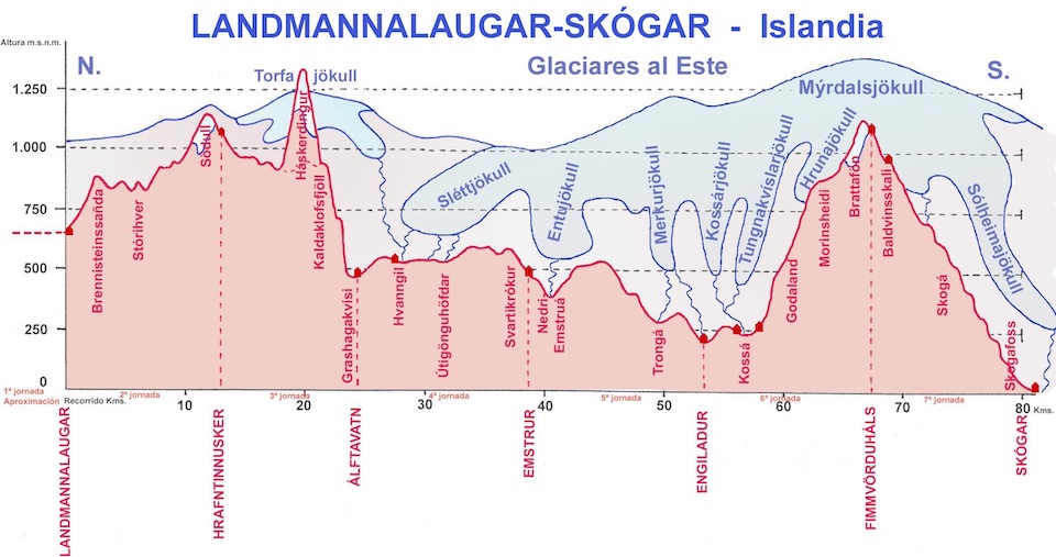
In the first leg of the holiday, we hiked our way through Iceland over the Laugavegur trail and the Fimmvörðuháls trail, which are connected in the Þórsmörk area (which actually an area with a lot of trees, despite the urban myth that Iceland does not have trees). You can see the height map of the trails below.
Hiking the Laugavegur and Fimmvörðuháls trails
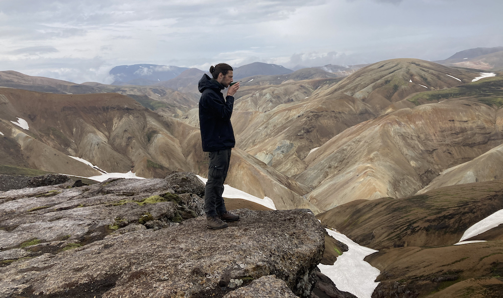
On July 29, we landed in the evening in Reykjavík and put up our tents on the Reykjavík Campsite. At the dawn of the next day, we took the bus to the first hut, Landmannalaugar. Despite the fact that we easily could start the hike, we camped here for a day, which allowed for an impressive evening walk on a green-ish mountain. My iPhone camera did not really capture the color as it actually was. It was so incredibly green/turquoise, very remarkable!
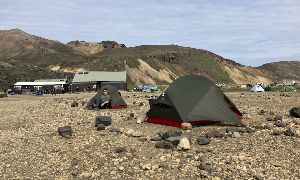
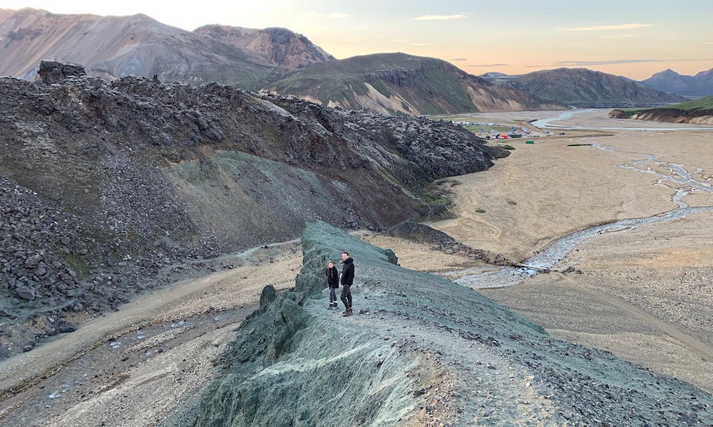
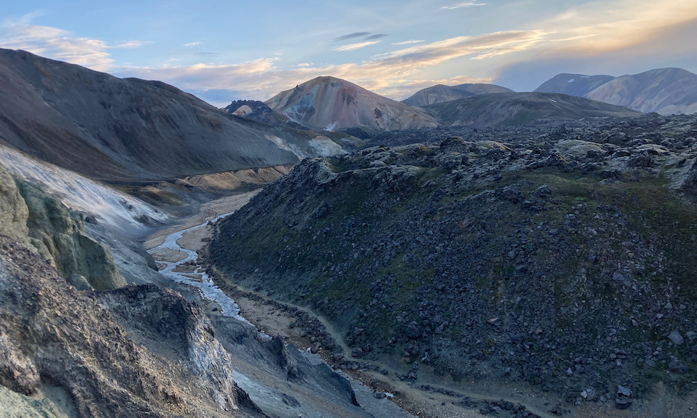
On top of the green ridge we had a marvelous view over a lava field that we would pass through the next day, during our first official hiking day. Even though we did not even start the trail yet, we already had a great time!
Landmannalaugar → Hrafntinnusker (~12 km)
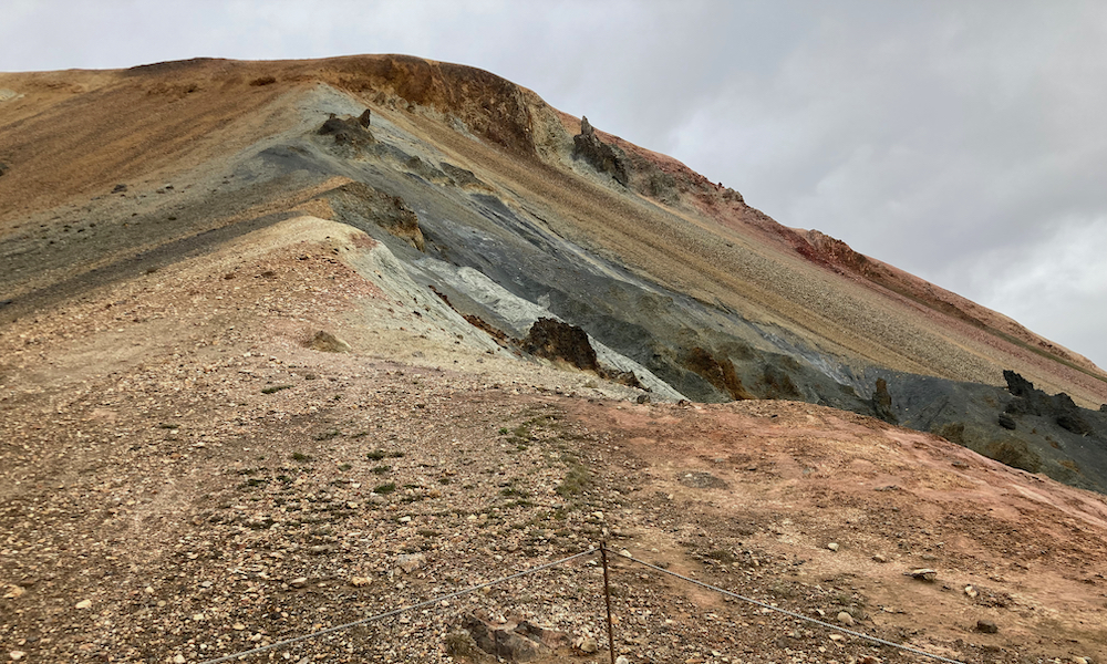
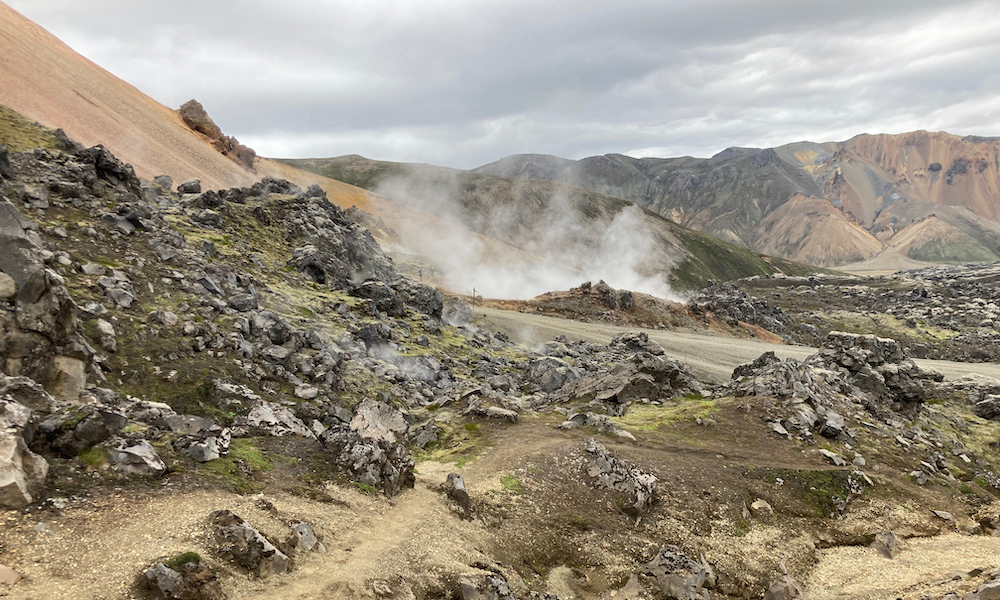
This was the first day of the 80km trail that would take us eventually to Skógar. It started with a path through the impressive lava field we overlooked the evening before, and we quickly walked into the so-called rainbow mountains or rhyolite mountains. Since Iceland is basically one big volcano, walked through a lot of active geothermal areas, accompanied by the stinging rotten-egg smell (sulphur) that was hissing, boiling and smoking out of the ground.
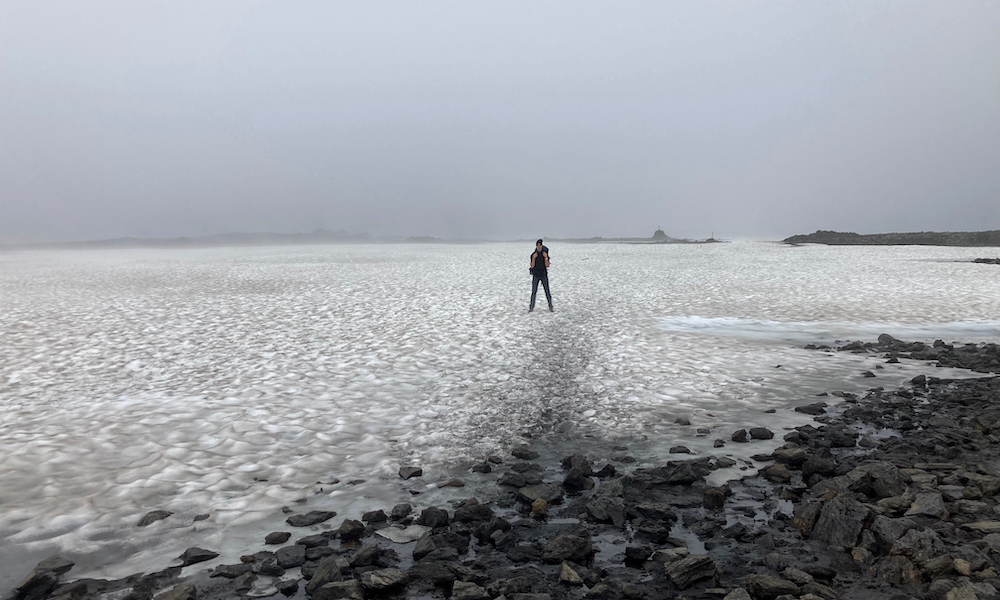
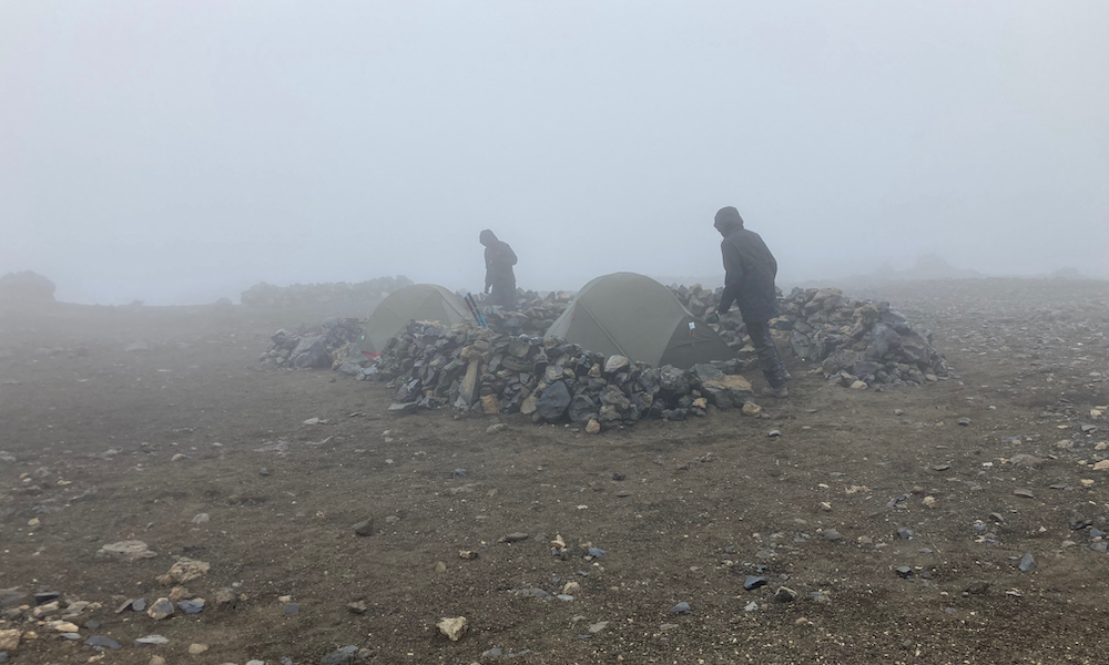
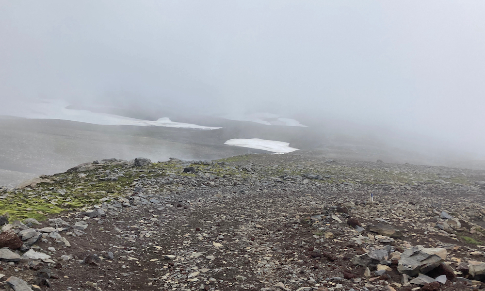
As we climbed higher, the rhyolite mountains were left behind and the scenery went from colorful to grayscale. We walked across snowfields that were resting on black, volcanic rock. The fog, which was getting thicker the higher we came, made this part of the trail kind of desolate, which actually contributed to the diversity of the (holi)day. When we arrived at the Hrafntinnusker hut, the fog was so thick, we could not even see the campsite, which was about 50m away from the hut!
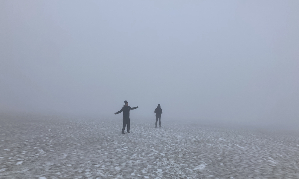
After setting up our tents and having some dinner, we wanted to do an evening hike (as if we didn't hike enough...). Some enthousiastic Americans told us to visit the ice caves, which was only a 1 hour hike from the hut and super cool. So, with the fog still thick (visibility of about ~20-30m), we started the trail to the ice caves. After a while, we came to a snowfield with a slight gradient down and this would be the correct way to the ice caves. We didn't see anything else but snow, but we thought; "Ah, we can only see for about 30m, so there will be a marking pole after about 60m or so", hence we started descending the snowfield. After 5 minutes, nothing but snow, after 10, 15, 20 minutes, nothing but snow and fog around us. We only knew what was up and down! After rethinking all the bad things we did in our lives, we finally saw "land", and soon after the impressive ice caves. It was a nice evening hike, but a bit scary as well!
After returning safely at the campsite, we immediately jumped into our sleeping bags to physically prepare for the next day. Luckily we have good sleeping bags, as the temperature dropped significantly during the night (I did not measure it, but I wouldn't be surprised if it was around 1°C that night).
Hrafntinnusker → Álftavatn (~12 km)
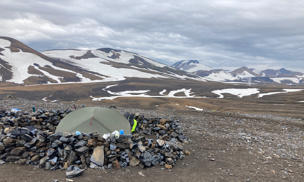
When we woke up in our tents the fog had cleared an the view was magnificent; we finally saw where we were camping. As you can see on the map, this part of the trail first climbs upto around 1300m, and then descents to around 500m. Right after we left, it started raining, and it kept raining until we were past the highest point of the trail. These circumstances made this trail the most difficult one of the Laugavegur trail.
At the top, or at least after a long climb, we made coffee. The rain stopped when we finished our coffee with this beautiful view! We entered a rainbow-mountain-rich area again as we progressed towards Álftavatn, crossing multiple geothermal areas. We needed to watch out step, actually, because the rain made the trail quite muddy. The more we descended the greener the scenery became. The rocks and clay traded for gravel and moss.
Álftavatn has a beautiful lakeside location and this lake could already be seen from way up the mountain. It is always nice to see where you're heading (even though you see it is still quite far away). After crossing a river on foot (it was about calf-deep, but still very cold), we arrived at the hut. This time we did not do an extensive evening walk, we were all too tired and went to bed quite quickly.
Álftavatn → Emstrur (~15 km)
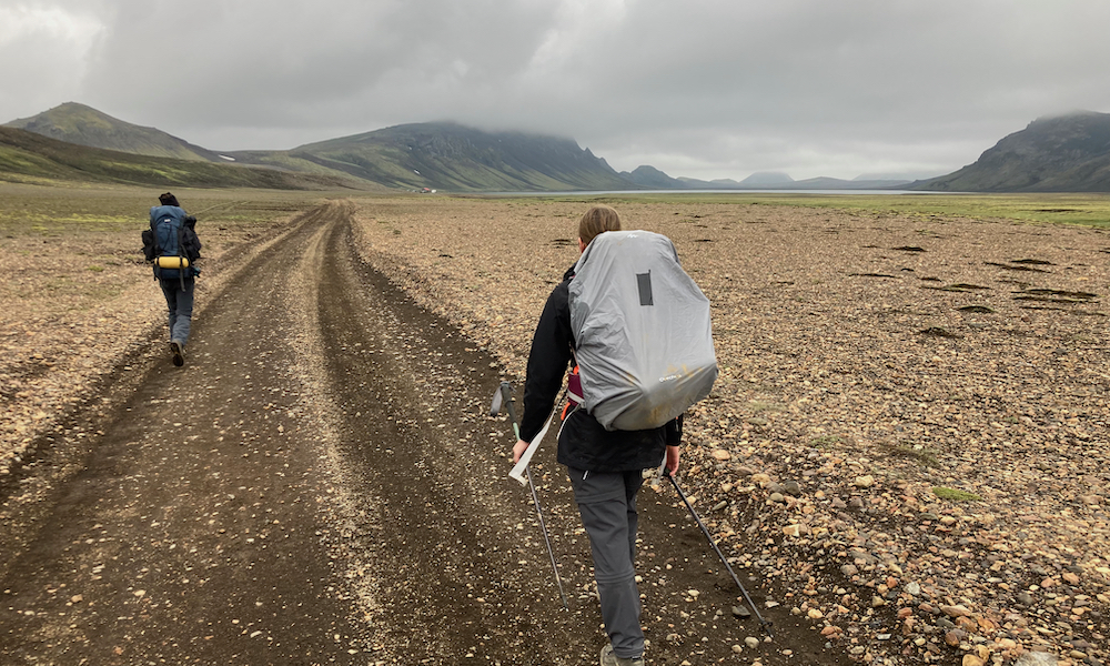
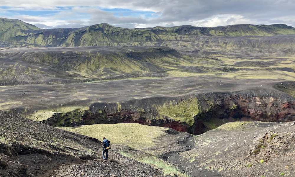
Fresh, after a good night of sleep we departed to Emstrur with good spirit. The trail did not involve as much climbing and descending as the previous two days, which was nice. The trail started with a green and mossy hike and quite immediate a river crossing. When after ~4km we arrived at the next hut on the Laugavegur (Hvanngil), we made our morning coffee. We continued our way to Emstrur and entered the Iceland Highland Desert (I it gave this name).
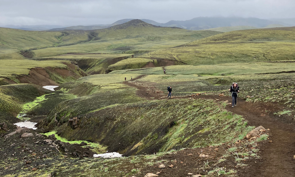
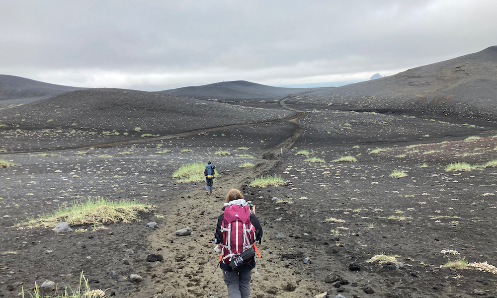
The Iceland Highland Desert is an area covered in volcanic black sand, here and there a lonely mountain, but mostly plain fields. It feels like you are walking on yet another country or planet. This part is again so significantly different than the rest. We were lucky that it was not that windy, as strong winds can cause sandstorms, which is not so nice of course. Someone, I cannot remember who, told me that there used to be glaciers here, which formed these lonely mountains and plain fields (I believed him/her).
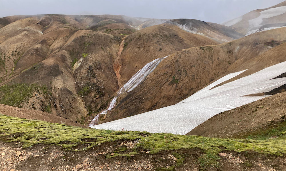
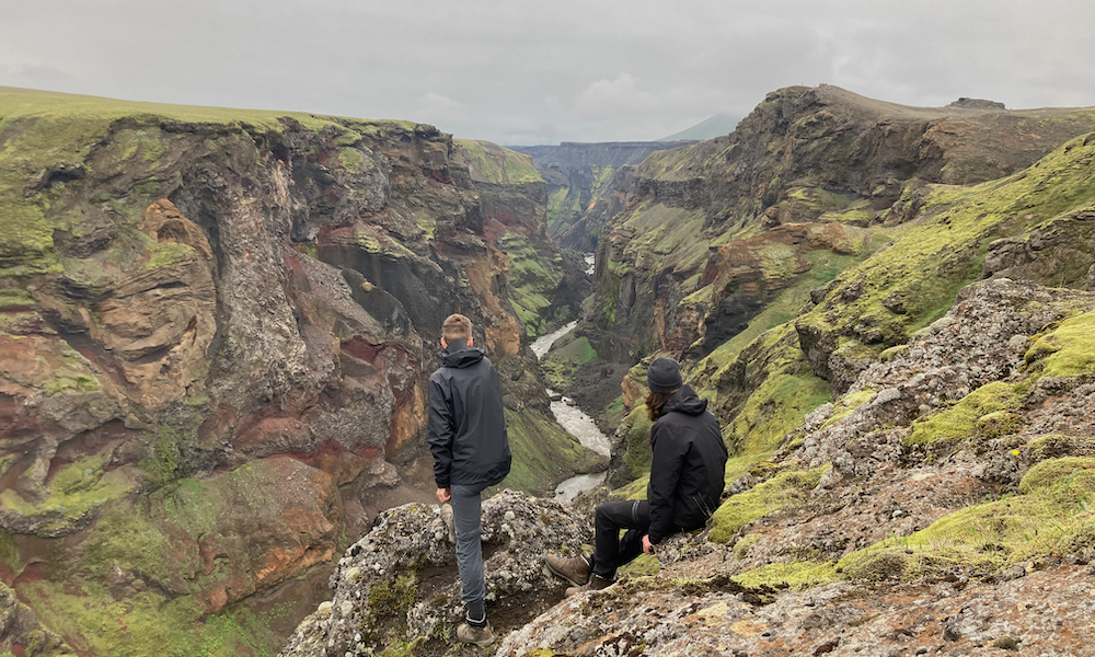
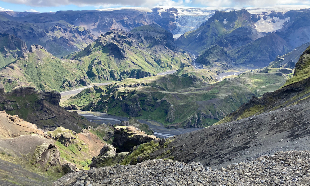
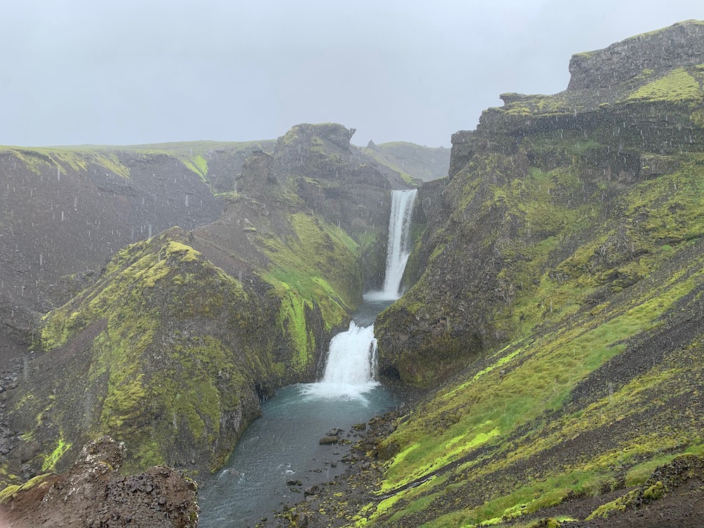
The black, desert lands led us to the Emstrur hut, which laid next to a picturesque stream. For this whole day we had very nice hiking weather, and this luckily continued in the evening. After putting up our tents and a nice adventure-food dinner, we went for a stroll. We tried to follow a route that was set out. Our first try did not work out, as we got stuck in some mossy field, and everyone knows that the moss in Iceland is sacred. Hence, we started our second try, which after about 30 minutes again seem to end up at nothing. Luckily, we saw some people in the distance and thought; well, there should be a path. I am very glad we saw those people, because we ended up on the edge of the Markarfljótsgljuófur canyon. An incredibly beautiful canyon, which is extremely deep and immensely colorful. You can see that I was and am very impressed. This was such an amazing experience! Definitely the most beautiful evening walk of the whole hiking tour!
Emstrur → Þórsmörk (~16 km)
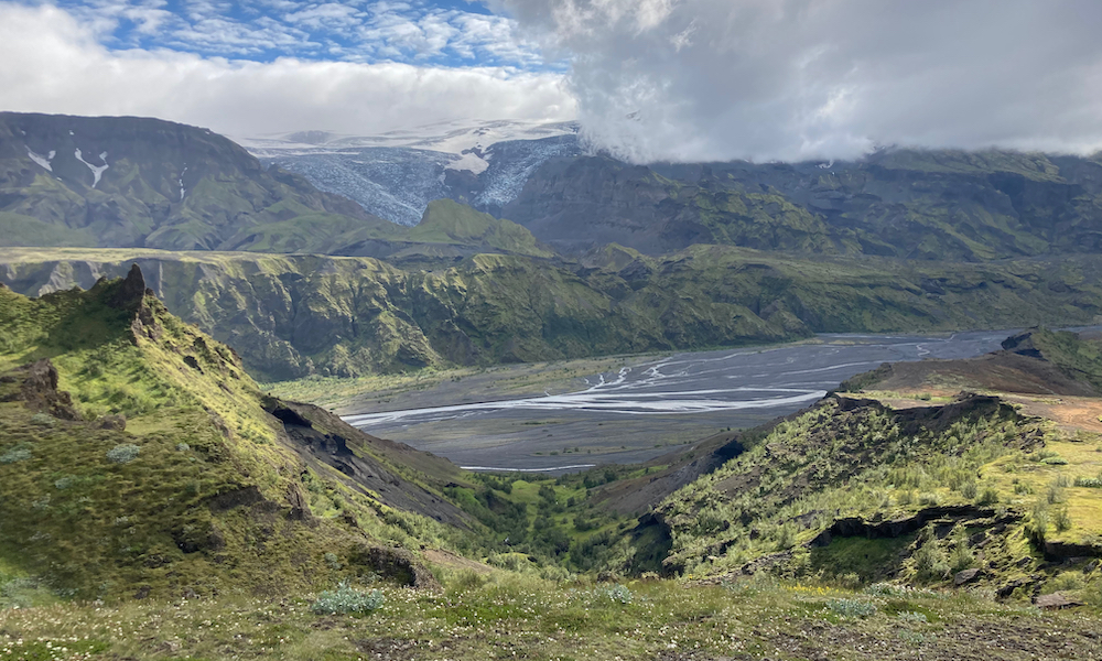
This day is the last day of the Laugavegur trail. We planned a resting day in Þórsmörk, so we need to take in as much of the Laugavur trail, now that it is still possible. The hike starts off with an information sign that explains how the Markarfljótsgljuófur canyon is formed and that such a canyon can form again quite easy, since we are facing the glacier covered Katla volcano (currently sleeping). Apparently, when the volcano erupts, the flood resulting from the melting glaciers is comparable to the combined average discharge of the Amazon, Mississippi, Nile, and Yangtze rivers(!!!!). Let's continue walking please...
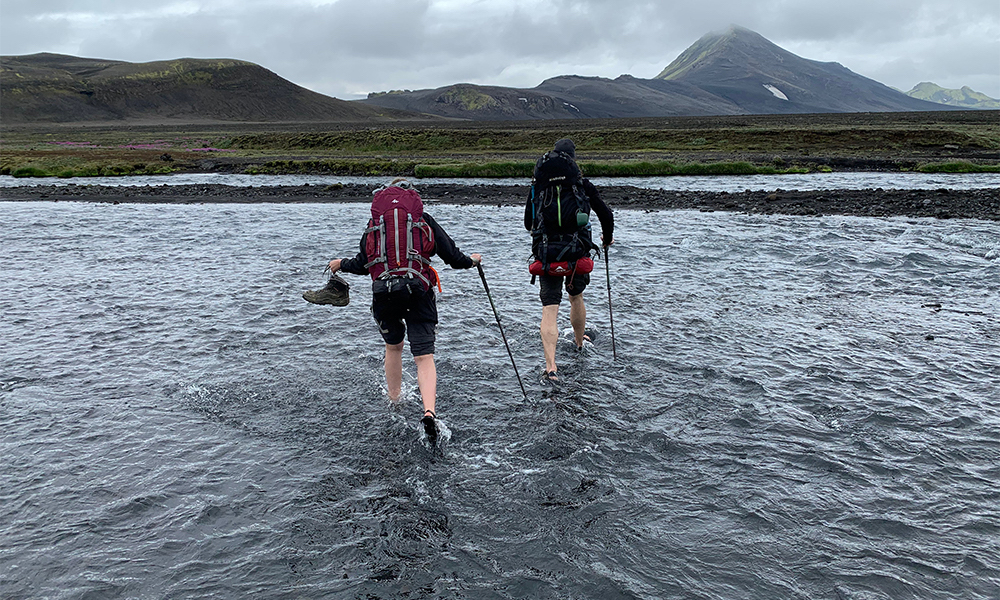
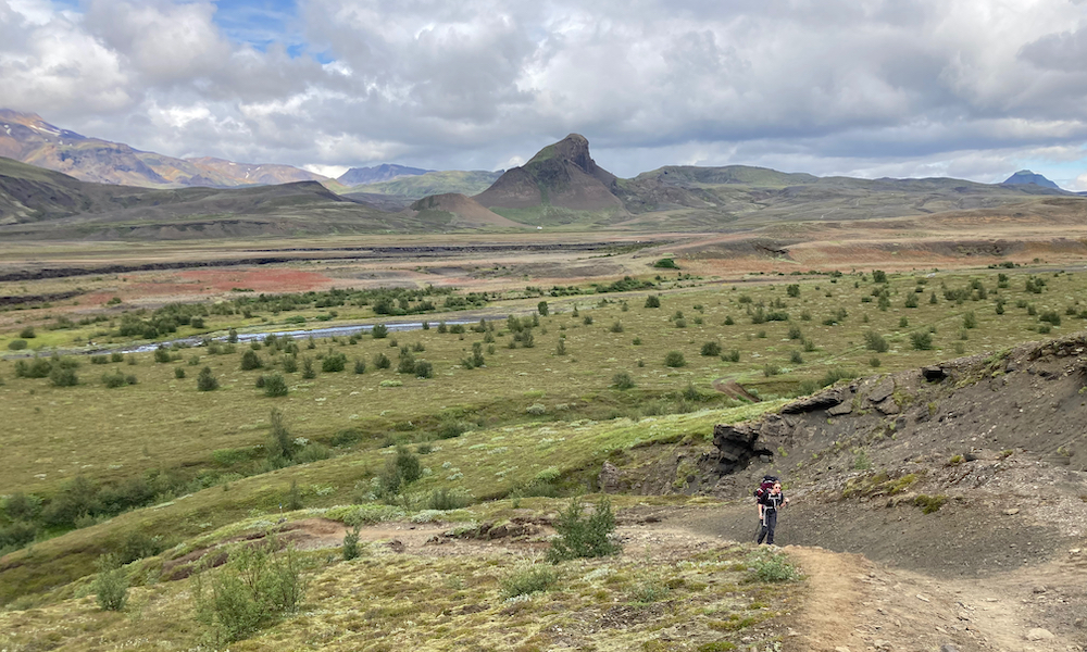
The trail led us over a small brigde that allowed us to cross a narrow part of the Markarfljótsgljuófur canyon, and continues in a glooming landscape that became greener every step. On this day we could clearly see what was ahead of us in the upcoming days, since we were walking straight towards the glaciers 'Eyjafjallajökull' and 'Mýrdalsjökull'. The Fimmvörðuháls trail lies between these two glaciers. The trail is not difficult in terms of elevation, but the length and the fact that we are almost at our resting destination makes that this part of the trail still feels heavy. Just before we hike more or less out of the wilderniss we need to cross an ice cold and quite deep river.
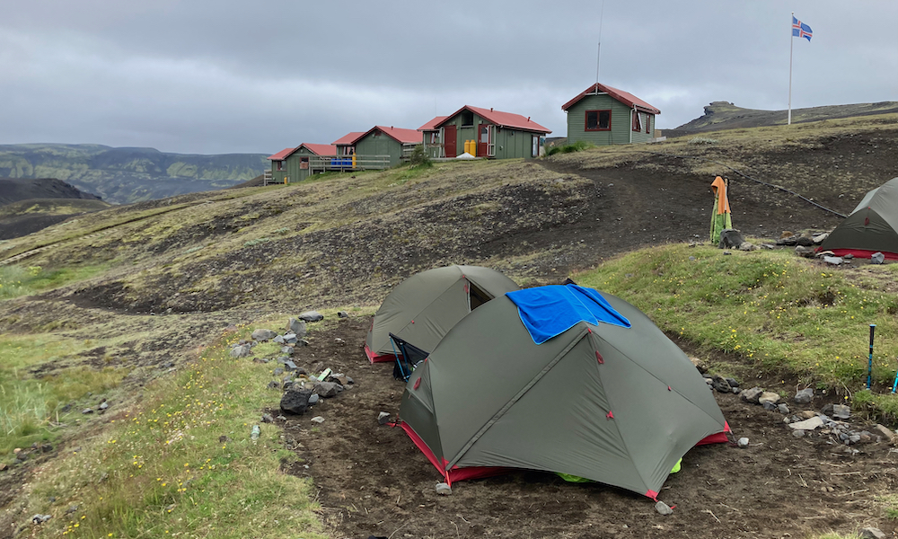
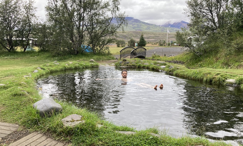
Finally, we arrive at an information that allows us to choose between two huts. To make the choice easy, they put the available facilities on the placard for both huts. Hut 1 had the standard facilities, let say 5 facilities. Hut number 2 had the standard facilities, plus: a hot pool, steam cabin, buffet, kitchen, shop, and some more I cannot recall. The list was 3-4 times as long! We obviously choose Hut 2 (Volcano Huts). That night, I enjoyed freshly cooked food as I have never enjoyed before; it was an all-you-can-eat buffet, and well... I did. We enjoyed some beers, good food, played some games, went to the steam cabin, into the hot pool (which was not that hot, by the way), we even met some fellow dutchies! That evening, we went to bed very peacefully and had an awesome night of sleep.
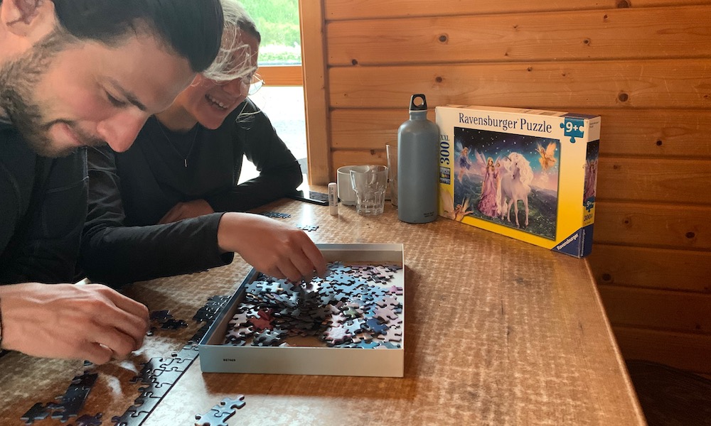
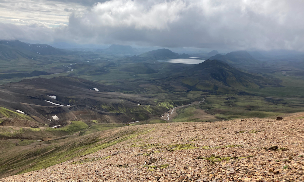
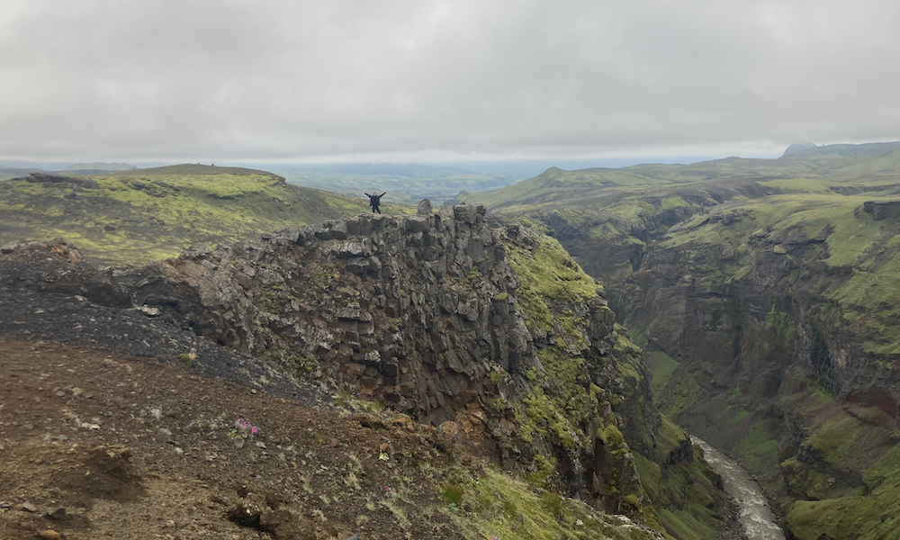
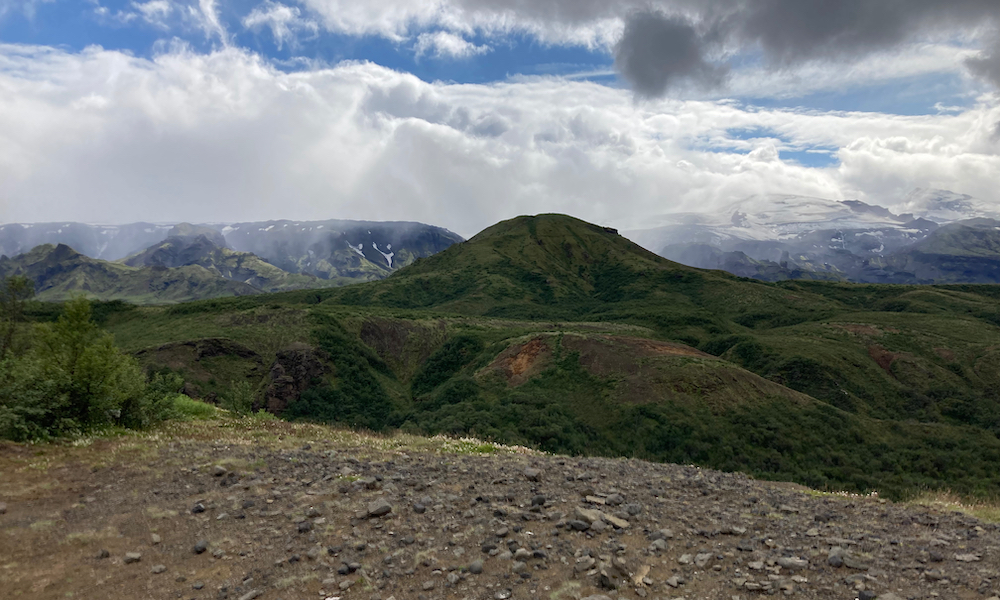
The next day was our resting day, and we mostly just rearranged our backpacks, went into the hot pool or steam cabin or played some games. We also went for a small hike, which resulted in a marvelous view over the whole Þórsmörk area. The next day, we would start the Fimmvörðuháls trail, and due to the uncertain weather conditions it was a possibility that we needed to hike the full trail (30km) in one go. Therefore, we took it slow and mainly prepared for the next day (so, no beers that evening).
Þórsmörk → Skógar (~30 km)
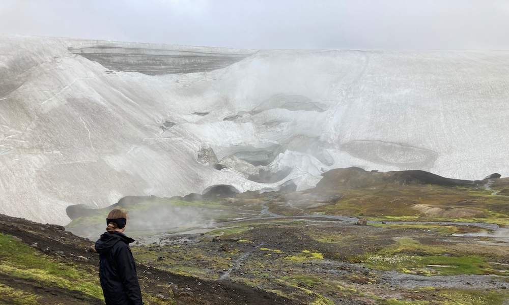
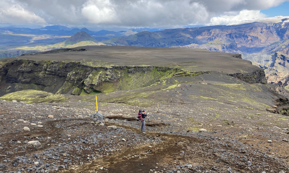
To be sure that we would be able to complete a 30 km hike, we left early in the morning. From the green fields of Þórsmörk, we hiked up to about 1000 meters, with marvelous views over the Laugavegur trail that we left behind. Just like all the other days, this was a part of the trail that you have not seen before. Especially the ascending part was much more rough than the parts on the Laugavegur trail (it felt more like a trail in the Alps). After a few hours of climbing, we suddenly ended up at a flat part of the trail, the Fimmvörðuháls highlands, where on our left we saw the magnificent Mýrdalsjökull glacier.
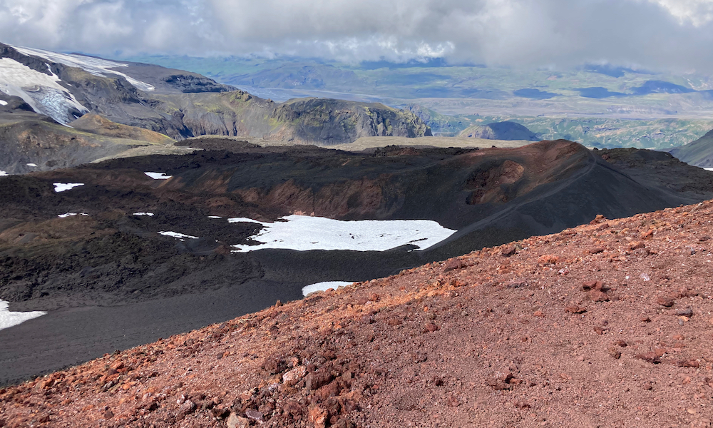
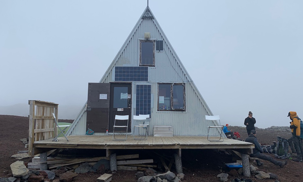
Close to the highest point of the Fimmvörðuháls trail, we saw the crater of the volcano covered by the Eyjafjallajökull ice cap. This volcano erupted in 2010 and caused quite some trouble worldwide (especially air travel). Continuing in an ash-black, snow-white scenery, we eventually reached the hut on the top. This was around 13:00 o'clock, which meant time for lunch! While enjoying some noodles next to the hut, we saw a cloud approaching us, and within minutes we were surrounded by thick fog. Besides the fact that our view was gone, it felt like that the temperature dropped about 10 degrees within 5 minutes. This was a good reason to just complete the Fimmvörðuháls trail in one day, instead of camping there in the cold. The descent started smooth and soon the first streams of melting water formed a large river with a lot of waterfalls.
Unfortunately, the weather gods decided that the river was not full enough, as it started raining. Therefore, we quickly continued the hike. We came across so many waterfalls that, eventually they weren't even special anymore. I believe that, from the top, you pass around 40 waterfalls. When we were almost there, Thomas unfortunately broke his arm due a nasty fall over the slippery mud. He luckily could continue the last few kilometers to Skógar, where we were being picked up by an ambulance. They brought us to the small town Selfoss, somewhere between Skógar and Reykjavík. Here, Thomas was treated in the hospital, and we spend the night in an AirBnB. The next day, we went to Reykjavík by bus. Although the end was a bit hectic, we are very proud of ourselves that we completed the Laugavegur and Fimmvörðuháls trails. It was an amazing experience with incomprehensible views!
Tourist days in Reykjavík
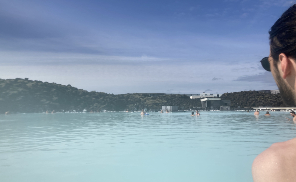
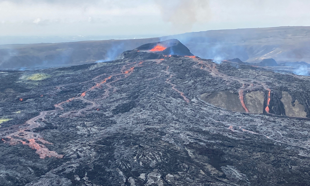
For our days in Reykjavík, we had a well-deserved hotel. It was so nice to sleep in a proper bed! Reykjavík itself is a very nice city; it is clean, pedestrian friendly and you can see most of the city center just by foot! In Reykjavík, we had planned two activities: Swimming in the Blue Lagoon and visiting the erupting volcano near Fagradalsfjall. The Blue Lagoon is often referred to as a tourist trap, as it is quite overpriced, often extremely crowded and there are much more interesting hot springs in Iceland for free. We however did not mind, especially being in primitive comfort for the last week, and had a very nice time there. The next day, we went to the Geldingadalur area to visit the erupting volcano. Seeing such a unique force of nature is very impressive. Next to that, it also was a nice hike! This was an excellent closure of our holiday, which we won't easily forget.
I hope you enjoyed reading this blog. Feel free to contact me if you have any questions regarding the holiday.