
The 2023 hike in Gran Canaria 🇪🇸
May 2023
Hi! Welcome to (another) blog about my hiking adventures. This blog presents the adventures Kaya and I had during our hiking holiday in Gran Canaria. Kaya also made a vlog series about our holiday (with English subtitles, thanks ChatGPT for helping out here), which you can find here! Quality content! (In my humble and unbiased opinion).
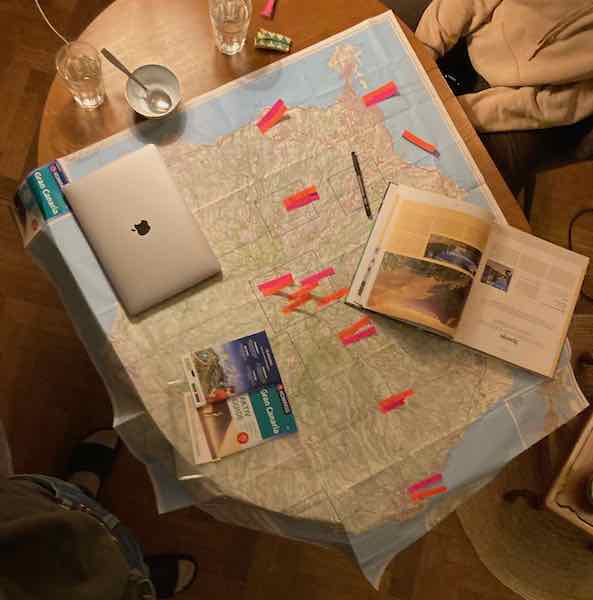
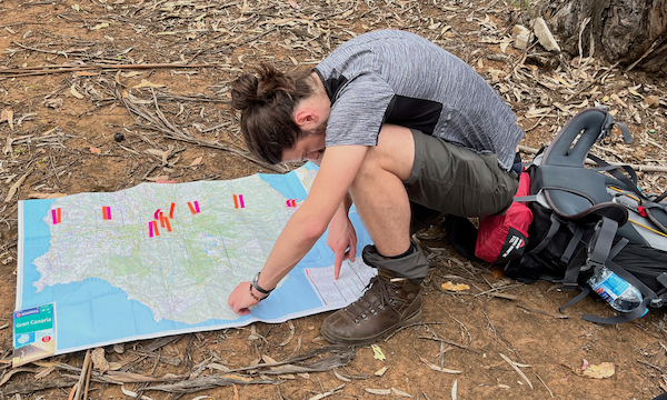
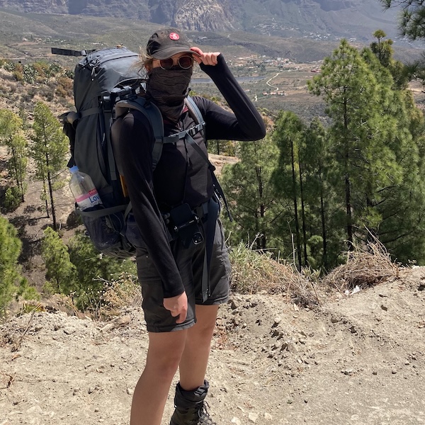
From April 7 to April 17 2023, my at-that-time girlfriend/fiance and I (see Día Très) hiked through one of the Canary Islands - Gran Canaria. Based on a multi-day hiking trip set out in a book by Lannoo, we decided to trek from the north of Gran Canaria, across the volcanic island to Maspalomas in the south. This route was described in a... rather unclear fashion, which implied that we needed to basically plan out the route ourselves. For this, we used a map by KOMPASS, the Lannoo book, the website by Caers Bart and Google Maps.
Día Cero: Getting there and final preparations
When the day of April 7, 2023 had only been going for about two hours, we left Eindhoven and the holiday officially started. We took the plane from Schiphol, which brought us directly to sunny Gran Canaria. We arrived around 10 o'clock in the morning, local time, and took the bus to Las Palmas de Gran Canaria (which is very easy to do, just using the public transport planner on Google Maps). In the city of Las Palmas de Gran Canaria, we had booked a hotel to at least have a place to sleep for the first night. Before we could venture on our hike, there was one task to complete. In order to prepare the Adventure Food and make the instant coffee, we needed a gas canister for our mini stove (you cannot take these with you on a plane, obviously).
Armed with Google Maps, money and hope, we searched the city for gas canisters. Our first target was an outdoor shop in the city center, which was closed. We did not take into account that literally everything was closed, because it was the Easter weekend: the hope started to fade. After visiting all the gas stations we could find in the area, we did not have any luck and went back to the hotel. The hotel owner, a very kind hippie-like figure, gave us some suggestions to try the next day. Let's hope for the best...
Día Uno: The adventure starts
The suggestions by the hotel owner unfortunately did not work out, and as we did not want to delay our trip, we gave up the search. We started the Gran-Tour from the bus stop of San Andrés (about 40 minutes by bus from the north of Las Palmas de Gran Canaria). We spotted a BP gas station nearby, and as a final attempt to get a gas canister, we went inside. No luck. In fact, throughout the whole holiday, we didn't see a single suitable gas canister (only ones you need to puncture).
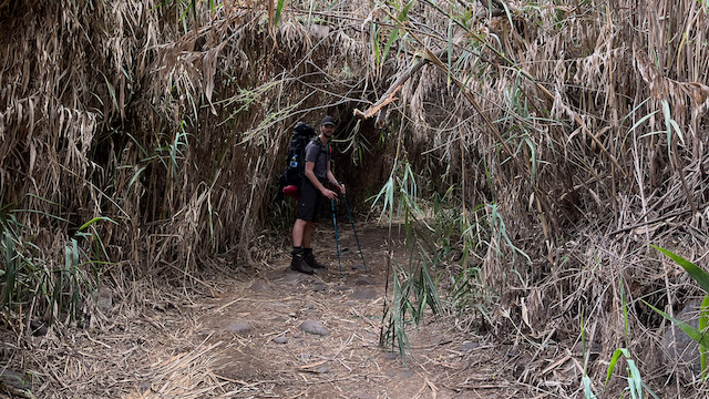
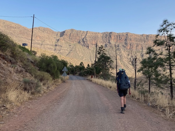
The hike started smoothly on a dirt road heading south in a desert-like landscape. The path gradually changed into a corridor enveloped by dense palm tree leaves on either side. Quickly, the leaves started forming a tunnel where I barely fit under. Despite the tire tracks on the path, it really felt like 'the wild'. After a while, we walked on a road which mainly seemed to be used by farmers, as on both sides there are plots of land with (what seem) orange trees and other crops. All of a sudden Kaya heard a very loud buzzing! A bee thought her bun of dark blonde hair resembled a flower... Panic in its most pure form! I tried to swat the bee away from her, which resulted in the bee being stuck under the shoulder pad of the backpack. Panic level 9000 - the bee was stinging her. In a split second, the backpack is off and I yoinked the bee off her back, which resulted in the bee following me. I ran away and manage to lose the bee. Somehow, the bee did not inject any venom as there was no reaction, luckily. With some remaining shivers down our spines, we continued the hike. This happened only... 1.5 hours in. That sounds promising.
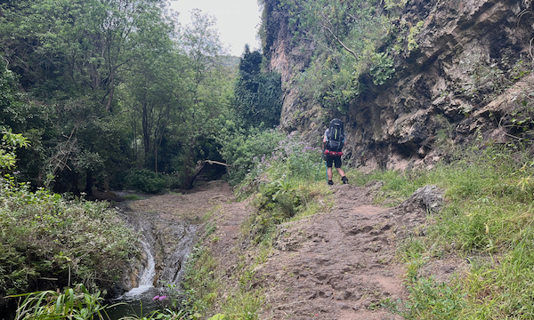
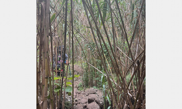
Till lunchtime we did not meet anyone on the trail, except for a single farmer. After lunch, we ended up on a very nice trail, and came across more and more people. Day hikers were hiking this part of the trail, which apparently is very popular. It's a very nice meandering trail in a small canyon, hidden away by trees and following a small stream. Some parts even involved some climbing. Following the map, we hiked up through a very dense bamboo/palm leaves forest, the number of people we encountered quickly dropped to zero. Hmm... At some point, in a slightly more open area we stumble upon a sign. Checking our (GPS) map, we see we are not on the path anymore, and the places indicated on the signs are not the places we need to go to. It looks like we need to go to the other side of the canyon, which seems impossible, given that there is no path. We head towards Moya, which is at least not going back. After a while, we ended up on an asphalt road and after some advanced navigation and heuristic cartography practice, the conclusion was that the map is either outright incorrect or heavily outdated. Nice memes...
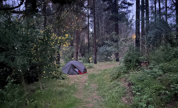
Further down the asphalt road, we ended up on a main road, where we were trying to find out where we actually were. On the other side of the valley, about as far from the intended destination as we already walked that day (it was around 17:00). We decided to hitch-hike, and directly the first car stopped to pick us up - island people are the best! The man brought us to Fontanada, a very small village with a single restaurant/hotel, which was luckily open. After some advanced communication (Duolingo Spanish, English and pointing), we managed to make our situation clear. We sat down in the restaurant (we were the only ones, because it was 18:00 in Spain) and ordered some local food. The waiter was an amazing fellow, who brought us some delicious food. He is a local, fond of hiking, and he gave us some very useful tips and tricks. He recommended an app called WikiLoc, which did have a correct map. He recommended us the correct trail such that we could get back to the planned route on the next day. So we were not completely lost. After we literally devoured our delicious meal, it was time to look for a place to sleep. Since there was no place to sleep in the hotel, our first night on our trip was going to be in the wild! Just outside of Fontanada, very close by the trail, we found a perfect spot to put down our tent. After checking whether our tent was visible from the road, which was not the case, it was time to go to sleep -- we deserved that!
Click here for the vlog corresponding to this day.
Día Dos: Volcanic ascent with proper navigation
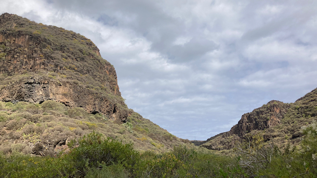
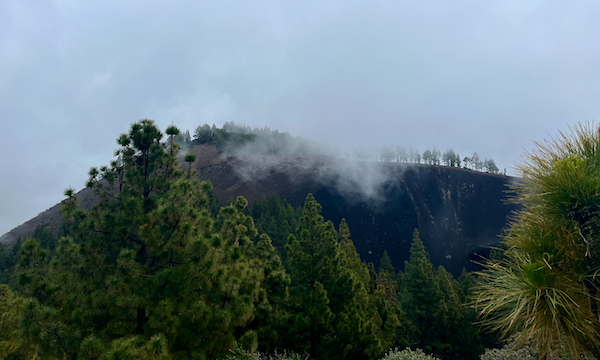
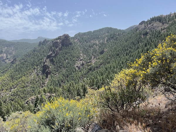
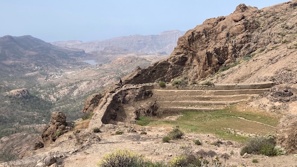
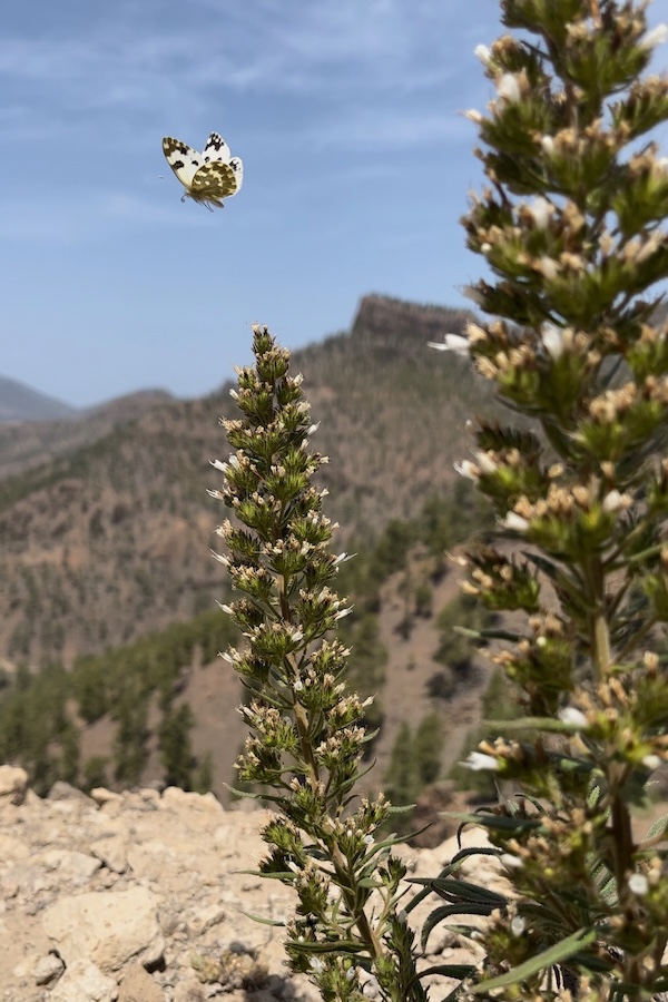
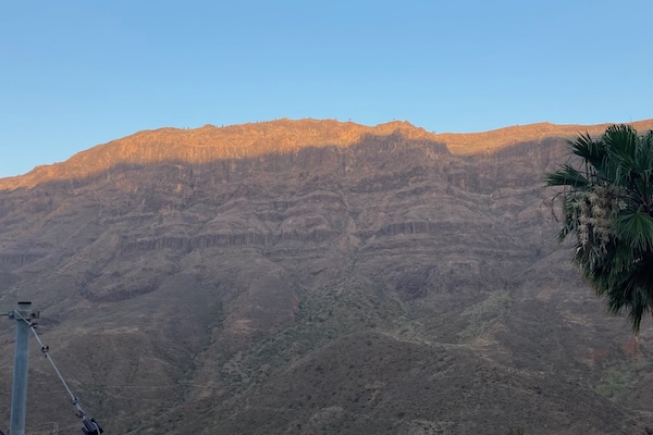
We woke up at the wild camping spot, feeling very relaxed, as our alarm clock was a symphony of birdsong. It really makes you feel at one with nature (I know, this sounds... hippy-ish). We quickly cleaned up our tent for the second day of hiking. We were a bit afraid of what we would encounter because of the adventures of Día Uno (which, as you will find out, was unnecessary). The tour started with a steep ascent (about 20%, i.e., 200 meters vertical for 1 km horizontal). Since we hadn't had breakfast when we woke up, we stopped halfway up the ascent to have breakfast with a view. The breakfast came, by the way, from the restaurant we visited the day before. We ordered the bread over there in Spanish (using Google Translate) and the waiter understood it! Once again proving that this was a golden guy. The trail we walked on was so much nicer than the day before, it truly felt like a blessing. Beautiful surroundings. Eventually, we entered more volcanic scenery, which, combined with the low-hanging clouds, made it mysteriously beautiful. After a steep ascent, we were rewarded with a very nice view of one of the larger craters on the volcanic island.
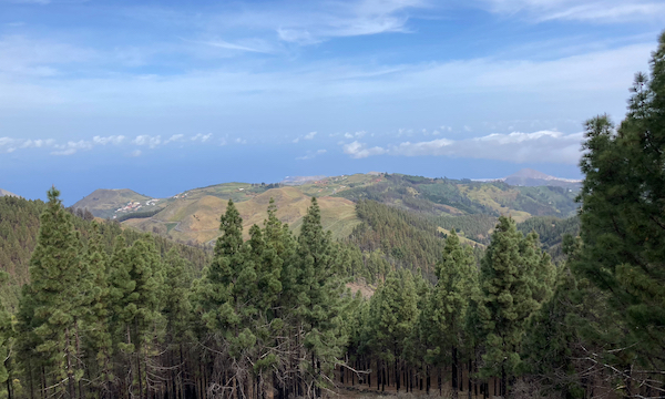
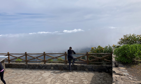
We continued our way in the volcanic landscape. We in fact walked through the clouds, which made it also a bit chilly (next to being very mysterious). We also met the first fellow-backpacker, which was really strange in some way. The hiking trails in Gran Canaria were generally very quiet. Slowly, the trail led us into the forest, where we had lunch in an open spot. Since the clouds were still hanging low, the forest felt really magical - somehow the green was greener and the brown was browner. Beautiful! Hiking a few kilometers through the woods led us eventually to a parking lot next to a viewpoint, overlooking a huge valley.
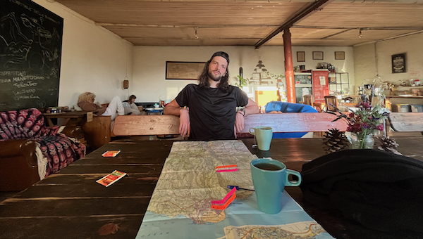
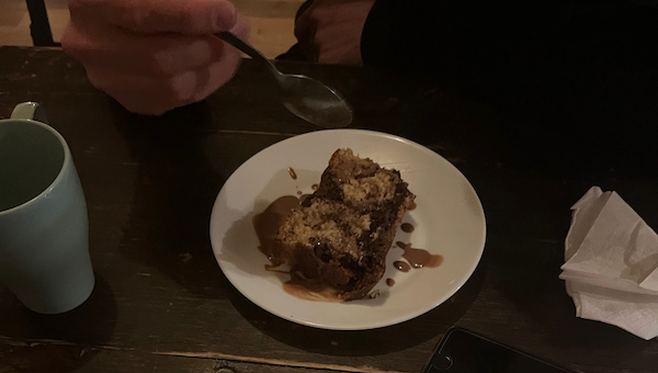
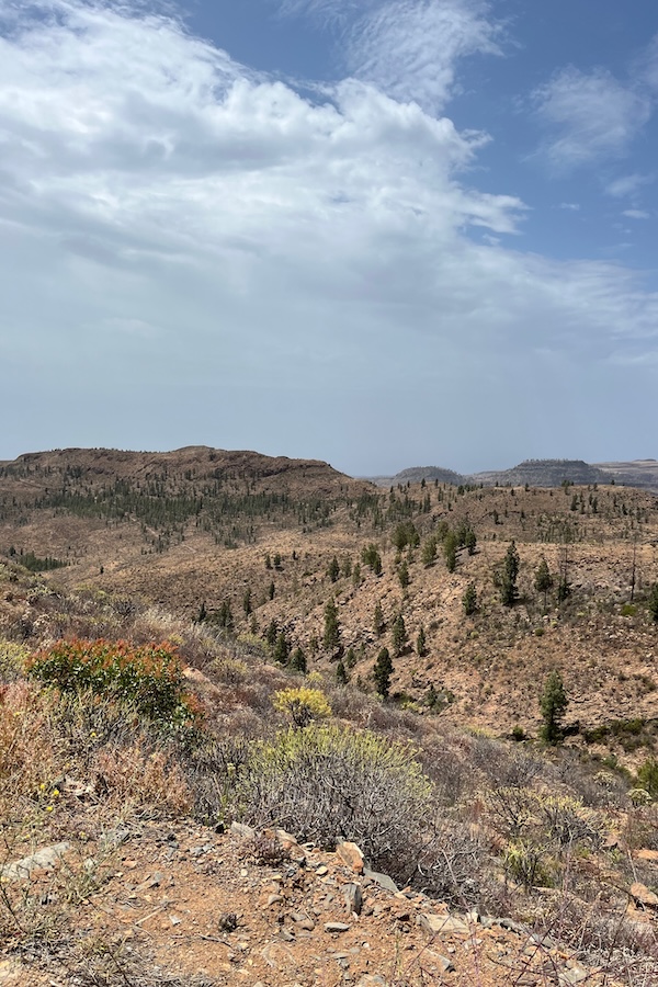
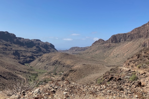
The viewpoint had a small open building next to it, in which a few youngsters were listening to (shitty) music and smoking shisha. Quite funny and alienating, haha. We took the hiking trail into the valley and hiked into a more desert-like landscape. The rock formations we passed were very impressive. This last part of the hike was quite a big contrast compared to the rest of the day. For the night, we had booked a hostel (Finca La Isa), which turned out to be a chill, hippy-ish hostel in the middle of nowhere. We had a decent place to sleep and the opportunity to take a well-needed shower. The whole vibe of the hostel was very relaxed, and the dinner that we were served was delicious and plentiful! Time to sleep.
Click here for the vlog corresponding to this day.
Día Tres: A day to never forget
After a good night of sleep in the hostel, we were ready to conquer another day of hiking in the beautiful nature of Gran Canaria. The hostel provided a delicious breakfast for us, and we made coffee using the 'drip 'n sip' coffee that we still had from our Iceland trip. A good start of the day!
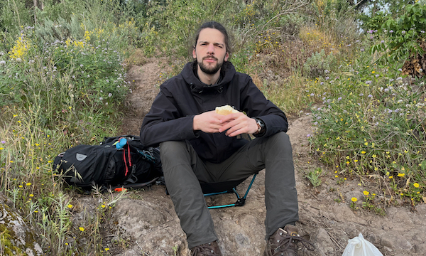
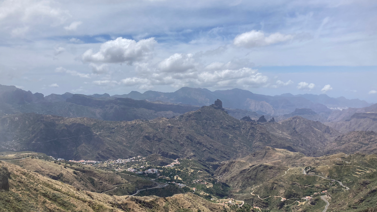
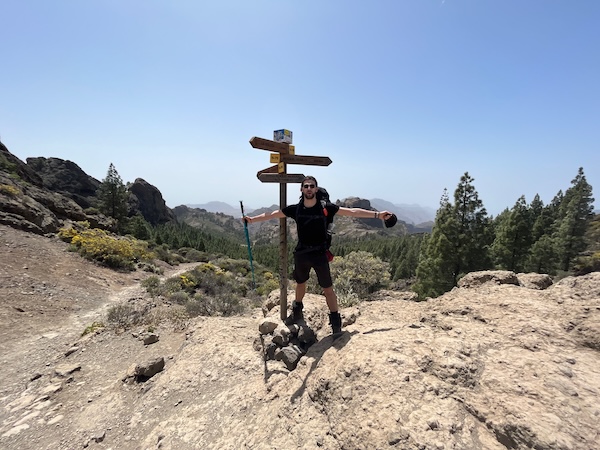
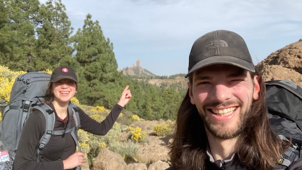
The hike started... funny. In the first 5 minutes, we went the wrong way twice. Luckily, this did not cost us too much time, and we could laugh about it. After we found the correct path, we ended up on a road that led us smoothly to the small village La Culata. The plan was to have lunch there, but we arrived so early that we only got a Coke and just bought some lunch for on the road. Again, a very nice lady at the restaurant, who tried to make some conversation in Spanglish (it went fine). After the Coke, the map led us quickly out of the village, steep up the mountain. Jeez, it felt like we were going up with a 45-degree incline, which, together with the burning sun, made it quite challenging. This part led us to Roque Nublo. This is essentially a menhir on steroids on top of a mountain and a popular tourist attraction. Apparently, it originated from the volcanic period and is the solidified vent of a volcano (called a volcanic plug). Halfway up the ascent, during which we had a continuously beautiful view, we stopped for lunch with the delicious sandwich from the 'La Culata' restaurant.
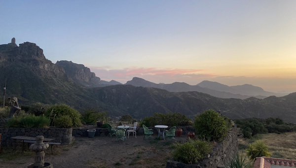
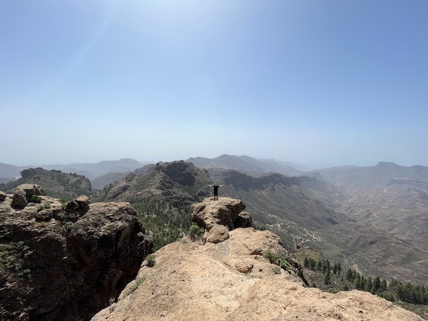
We had the choice to either walk around Roque Nublo and hike up the mountain to visit the Roque itself or take a shortcut and just enjoy the view. Because it was already quite challenging, we decided to take the second option. When we arrived at the crossroad, however, we experienced some major FOMO. How could we hike Gran Canaria and skip one of the major highlights?! Especially because the out-and-back trail to the rock was right there, we just could not simply bypass this. Hence, up we went. Roque Nublo is on top of a large plateau that is the highest point in the area; hence, blasting winds, scorching rays, and stunning views -- absolutely divine. Yeah, we wouldn't have wanted to miss this; Roque Nublo is quite an impressive unit. After taking some nice pictures, we settled for an orange in a small natural rock shelter in Roque Nublo (basically a small dent-like cave).
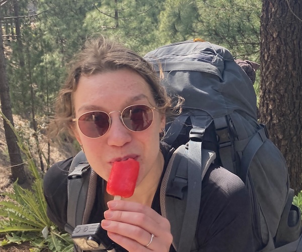
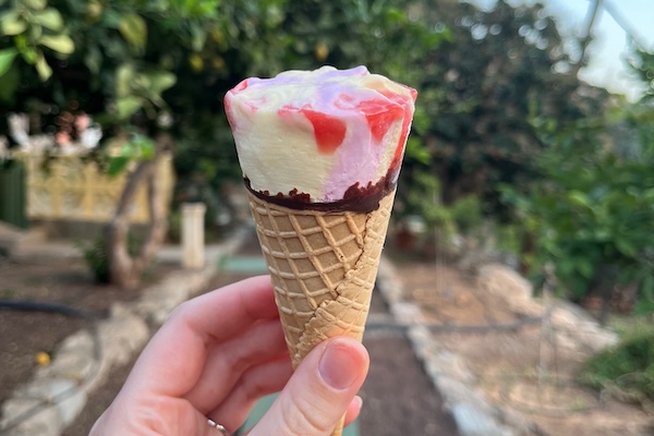
In this small cave, our lives changed. After I got the oranges from my bag, I also brought something else. So after we finished the (delicious) oranges, I started stuttering a bit awkwardly. Though, the message was clear, because Kaya said "Yes, of course I want to marry you!!" (in Dutch). After some tears of happiness and disbelief that this really happened, we had plenty to chat about during our descent back to the route. We also bought a popsicle on our way back to celebrate this surreal event. In the meantime, some big life questions popped up, and we realized that this question and this answer imply quite some major life-changes. We got excited talking about it and learned that we might even fit better together than we initially thought.
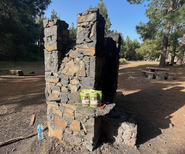
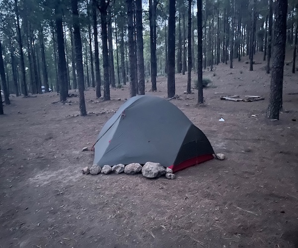
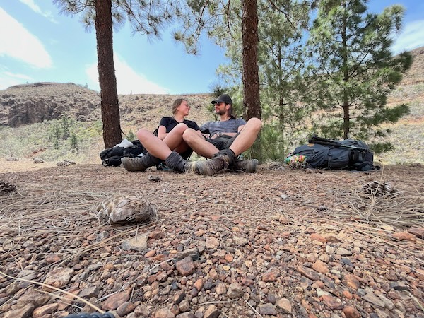
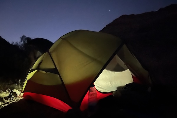
Although, this day has been great so far (with life-changing experiences and all), we still needed a place to sleep. A bit further down the trail we found a potential campsite. Wait... all these kids... a youth camp. No way. Even further, we found two options. One option had a lot of outdoor barbecue / fire pit installments, where we made a fire and cooked water for our Adventure Food. The BBQ spot was nice, but in the twilight many crows and ravens joined us, which gave a eerie cabin-in-the-woods vibe. We hiked to the other campsite just before night fall and put up the tent. This place was much better. It was time to experience our first night as an engaged couple!
Click here for the vlog corresponding to this day.
Día Cuatro: Battling wind
Waking up in a quiet pine forest, in a state we had never woken up in before. Engaged. Yesterday really happened. What a lot of fun. We started slowly that day. We had a hardtack breakfast in our lightweight camping chairs and have an easy day ahead of us. It turned out to be a bit harder than we expected though...
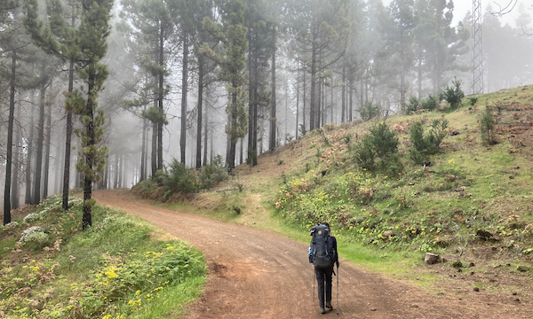
The hike started with a beautiful trail through the forest, which appeared to be part of the Camino de Santiago. The trail led us further up to about 1732 meters. The views we had in the meantime were stunning (we even spotted Roque Nublo). However, we hoped that we would come across some stands or stores to stock up on food, but no luck unfortunately. Once we reached the top, a steep descent on the pilgrimage route was ahead of us. The trail was a rough cobblestone path, it looked impressive and at some points very beautiful, but hiking it was not so comfortable. The environment was deserty, the sun was hot and the wind howled with a cutting edge.
So far, this has been the most difficult day, but mostly due to the weather and the lack of supplies. We both got a sunburn and were rationing on water and food. This is why we just steadily kept hiking to the AirBnB that we booked in the morning. After descending the cobblestone path to about 900 meters, we arrived in the town of Tunte around 14:00. A cute and picturesque little town where we had booked our apartment. We took a shower, a nap and washed our dirty clothes. What a treat!

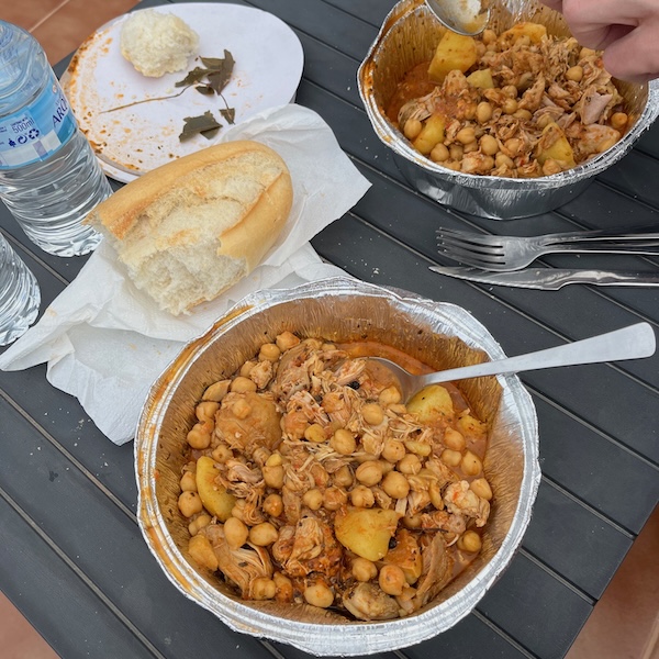
When we wanted to go out for supper, we found out that nothing in the town was open apart from one bar. The bartender greeted us, and two cerveza-drinking locals (both quite intoxicated, haha) were trying their luck on the slot machine. Luckily, the bar also prepared delicious chicken stew that we could bring for take-out. An amazing and delicious lifesaver! The bartender also referred us to a small supermarket at the other side of the street where we could stock up on water and food for the next day(s). On our way back to our AirBnB, we stumbled upon our neighbor who happened to be from Belgium. After a short chat, it was time for dinner on the roof terrace of our apartment. Believe me that we truly enjoyed this meal. After we called our family to tell about yesterday's life-changing event, we really earned a good night of sleep.
Click here for the vlog corresponding to this day.
Día Cinco: Descending towards fire
We slept in a little and woke up slowly around 8 am in the apartment. Without too much trouble, we packed up and got ready for the day. We left the apartment and went to the local bakery that was located on the main (and only) square of Tunte to get our breakfast. The baker at the counter was kind and clear and did not need many words to understand what we wanted. Clearly, she had dealt with more tourists that did not speak a word of Spanish. All in all, we considered her a star in communicating with people who did not speak her language. We ordered coffee and some food. Because I already had some leftovers from yesterday's dinner, I only had a plain croissant. Kaya, on the other hand, had a croissant sandwich and geez, you almost couldn't see the croissant! A great start of the day.
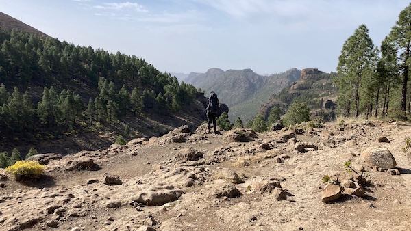
After we acquired some lunch sandwiches and water, we were ready to go and left around 10:30. We started off with a steep trail that passed right through the village. The trail was very cute and meandered between the colored houses of Tunte. The trail ended up at a farmers track that led us deeper into the mountains and the real climbing started. After a quick break in a small open cave with some shade, we continued and eventually reached the top at 1187 meters. We had already seen on the map that this would have been the highest point of this day and the descent started easily. The longer we hiked towards the south, the more the landscape became desert-like and dry. Very impressive!
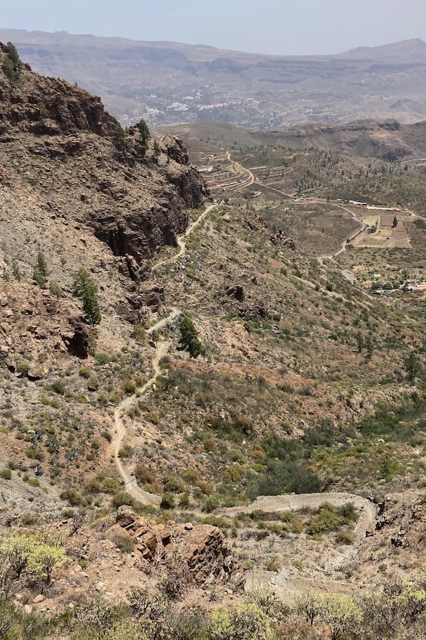
The gently sloping descent really helped us put some kilometers behind us. Under the few trees that are left in the landscape, we ate the sandwiches that we bought in the morning. It was here that we recorded some videos with the big news to inform our friends. After we got back into hiking mode, we passed a few perfect wild camping spots. The feeling of FOMO crept up on us, because we already booked the next accommodation. Oh well, a shower is also nice.
As we got closer to the final major descent, we started to hear sirens in the far distance, but from the direction we were heading to. We couldn't see anything, but we saw on the map that there was a road at the other side of the mountain where we were on. Kaya thought it maybe was the emergency siren, but I was a bit more nonchalant about it. When we finally reached the top, meters before the descent plunges into the depths, we have a beautiful view over a valley. We saw the steep, difficult and technical upcoming descent, and in the far distance mini cars on a mini road where the sirens seemed to be coming from. When we look up into the north, we see smoke plumes rising from the ground... fire!
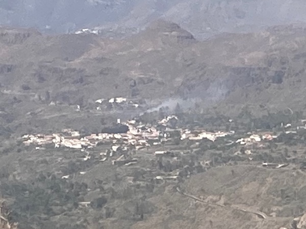
Since the apartment that we booked was also in this direction, we were a bit afraid we needed to camp after all. After some advanced cartography we found out that the fire was a few kilometers further north from where we would stay. With this distraction, the descent was quite a bit easier. But when the sirens faded, the firefighting helicopters were out of sight and the excitement dimmed, we still were not at the bottom. Man, this was far down. Luckily, the shadow of the mountain where we came from, meant that we didn't have to walk in the direct sunlight anymore.
When we finally reached the feet of the mountain, it was still about 50 minutes of hiking north to get to the apartment (which felt as the wrong direction to us). We were a bit skeptical, but we were received by an extremely nice host. Because of the fire, there was a power outage. For this reason, we got a free upgrade to an apartment that was heated by gas. This meant that we were able to cook and have a shower. Such a kind man! The apartment was great with an amazing view. Really relaxing. In the evening, we had some adventure food, some tea and then it was time for bed. Everything hurts, but so happy and satisfied.
Click here for the vlog corresponding to this day.
Día de Descanso: Relaxing = boring...
After five long days of hiking, seeing beautiful nature, getting engaged, and eating delicious foods, we decided to take a rest day. An extra day in the apartment with this nice host would not hurt. During the first half of the day, we made the most of the fact that it was a resting day. We hung out to the max and did basically nothing apart from enjoying the weather and the outside lounge set. All the positive responses from our friends to the video were really contributing to the relaxedness of the day.
After a garlic-heavy lunch (which was delicious by the way), the boredom set in. We had already made our plans for the next day, we did not need to pack anything, and our legs felt great again. We were so eager to get back on the trail. Somehow, also Kaya's dinner flopped so after watching the sun drop below the mountains, we went to bed and waited for the next day to come.
Día Seis: Hiking and sleeping in the desert
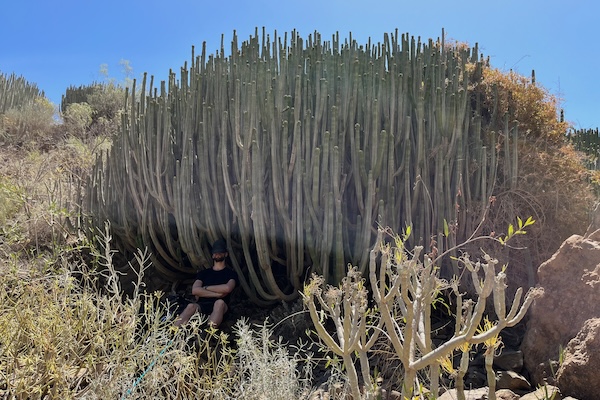
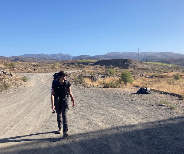
After the well-deserved, but a bit too long, resting day, we woke up with good spirits. The host made us a great breakfast, eggs and bacon, and even suggested making us sandwiches for lunch. Of course we could not refuse. After we packed up our gear, we were ready to go. Standing in front of the entrance, checked out and all, we were about to leave when I still felt the key for the apartment in my pocket. Luckily, just in time, we for sure didn't want to hike back. The hike that day started along the regional road, getting quickly quite a few kilometers behind us. Halfway through, we came across some kind of camel farm, quite funny to see the animals perfectly matching with the desert landscape, despite not being in the wild. When we left the main road, we arrived at a small, picturesque village with, apparently, quite some history. A bit further down the street, we found many archaeological sites and passed a bench with many Dutch phrases written on it... funny. When we left the village, we walked through a burial site (Necrópolis de Arteara), which has apparently been used by the natives from 500 BC onward! The map led us on a desert trail through the desert, fully exposed to the scorching sunshine. Luckily there were no big elevation changes, so we made a lot of kilometers passing the huge cacti. At a certain point we came across a local farmer that started talking to us in Spanish. With the few Duolingo words of Spanish and some hands and feet work, we found out that he was asking us whether we had enough cold water! After he had put his hands on my water bottle in my bag, we were allowed to go on. What a golden guy! At the farmer's garden shed thing, we saw our first (!) lizard (after hearing about a thousand of them). After petting the lizard (scariest day of its life) we could continue into the desert. We had a short break in the little shade of a HUGE cactus and ate our lovely lunch a bit further down the road in the shade of a humming electricity substation.
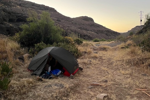
After a few hours we passed what seemed to be a quarry. On the other side of the road, we saw some small caves where we chilled out for a bit, out of the sun and with our legs at rest. After cooling down for quite some time, it was time to get back on our feet and finish the last kilometers to Maspalomas. After some time, we finally reached the outskirts of Maspalomas. We already picked a restaurant via Google Maps, but this one was closed. Luckily a much better-looking restaurant across the road was open and we had a well-deserved Coke. We got some supplies at a supermarket and went back to the restaurant for a delicious meal. Now we were ready for a night of wild camping in the desert. The way to the camping spot we picked out (by simply eyeballing on the map) passed by a dumping ground, a shady and amateurishly cobbled together chicken (or hobo) coop, and a rock face with a bazillion holes and dark caves. The tension was rising, and the whole idea of us spending the night out here became scarier and scarier. We hiked along a bit further, further away from the coop (we were convinced by that time that it was the residence of some shady figure). At a certain point, we found a nice and flat spot to set up our tent. It is sufficiently far away from the main path, and the ground is not too rocky. After we had set up the tent, we checked whether it was visible from the path (it was not) and had a juicy orange before going to bed. Kaya already went to bed, but I stayed outside for a while to see whether I could spot the Milky Way. Unfortunately, we were still too close to the city to spot anything significant, so I also went to bed.
This is when the fun starts. We camped in some sort of canyon that was quite narrow, about 30 meters maybe, and it was quiet. Dead silent. Deafening silence. This means that you truly hear everything that goes on around you. Buenas noches... The tent was between two cactus shrubs, where probably those thousand little lizards were hunting for their food. This silence made their soft rustling sound like they were Komodo dragons. We needed to keep our tired minds cool to convince ourselves that everything was okay. After we grew tired of worrying about the rustling, we drifted into sleep and we could finally rest our tired bodies.
NOT. Somewhere in the middle of the night, we were woken up by a horrifying scream. What the heck was that?! It faded again, and we started wondering whether we didn't 'just' have the same dream. After a short while, again! A what to us seemed like a scream from the depths of hell seemed to fly over us. It started zooming and transformed into a sound I have difficulty even describing. We had no idea what it was, and guessed it was some kind of strange animal. The next day, we found out it was the call of a Cagarros, a.k.a. Cory's Shearwater. No idea. A bird, with a call that sounds NOTHING like a bird! After this little jump scare, we finally fell asleep again. What a day. What a night...
Click here for the vlog corresponding to this day.
Día Siete: Arriving in the dunes of Maspalomas
The alarm rang at 6 in the morning. Because of the short night, which we luckily survived, we decided to snooze for a bit longer. This is something we regretted when we were woken up by the sound of cars. They seemed to stop quite close to our tent, and as soon as the engines fell silent, the sound of dogs broke through. Our tired brains immediately convinced us that we got caught and were going to be directly thrown in Gran Canarian jail for wild camping without approval or whatever. A peek outside, however, allowed us to conclude that they were actually quite far away. It only sounded like that because of the canyon we were sleeping in. We quickly got out of the tent and packed up as stealthily as possible. Once we had packed everything and had breakfast, another car arrived and parked right next to us. The only interaction we had with the dog owner was a short wave when he was still inside the car. It was just some people enjoying the peaceful quiet of the morning to walk their dog. After our breakfast we walked back to Maspalomas. Not so scary after all. It was all in our heads, haha.
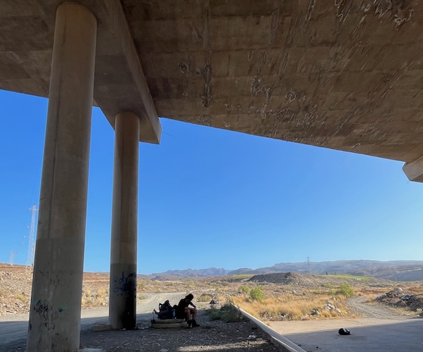

We booked our AirBnB for the upcoming night in the shade of an overpass. If we needed to pick one mistake that we made in this holiday it must be this AirBnB, as will become apparent later. The walk to the AirBnB completed the very last kilometers of our trip, and it sure felt that way. The city of Maspalomas felt (was, and probably still is) extremely dirty compared to the beautiful landscapes we had hiked through. Walking through the city, we came across three rats, dirty sidewalks, and it just smelled like pee in general. It felt like the heat of the sun made it worse. Personally, I was quite done with it. The dirtiness of the city was emphasized even more when we opened the door to our AirBnB. At a first glance, it looked fairly nice, just very tacky. But two steps into the room and we were welcomed with a huge cockroach lying on its back, still twitching. Gross. When we took a shower, little black cockroaches came crawling out of the shower drain. When I informed the host about it, he first blamed us, and then the previous renters. This is what I meant by that mistake.
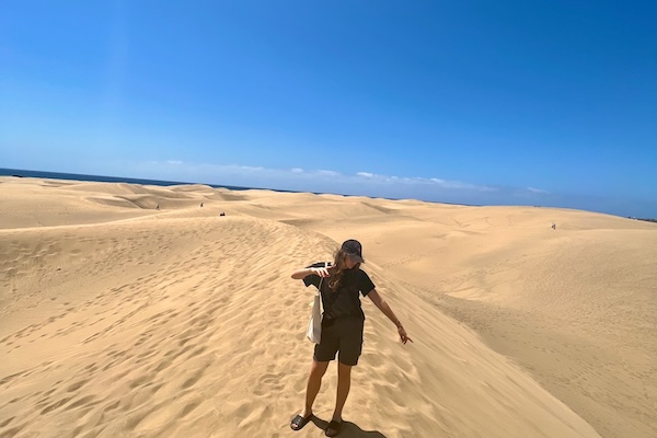
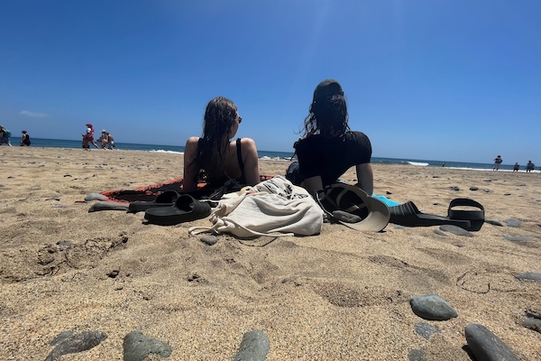
We left our gear in the apartment (as much from the ground as possible) and walked to the beach. We finally reached the sea. From sea to sea, north to south. We did it. Our most adventurous, lovely, exciting, and scary hiking trip completed. This felt great, despite the despicability of Maspalomas. Now it was time to relax in this mass tourism resort. The next day, we walked to the famous dunes of Maspalomas, which is essentially a small extension of the Sahara Desert. The dunes look nice and it certainly makes an impressive view, but it does not come even close to the beauty that we have seen in the past few days. This last leg of our holiday in Maspalomas was (and is) a good reminder that nature is always so much better. Although it is generally quite difficult to find beer and pizza there. Always a tradeoff.
Click here for the vlog corresponding to this day.
If you came this far, thank you for reading. I hope you enjoyed it! If you are thinking of doing something like this yourself and you want some advise or ask some questions, feel free to contact me!